|
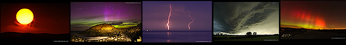
At first this looked to be just another marginal day in our worst Summer storm season to date which didn't really take my interest, however I was in the mind set now were I would just take whatever nature gave me, after all, I would be chasing anyway, so I grabbed a brew and took a look at the updated charts for August 28th and gradually I began to warm to the set-up. After a heavy band of morning rain a classic post-frontal air mass would move in across N. Ireland in yet another classic SWly flow with clearing skies and solar heating following in the wake of the front. Models indicated 400j/kg of CAPE in the W between midday and 15.00 after which the instability would begin to decline to between 100-150j/kg of CAPE, not impressive by any means and more like Winter standards than Summer, but at least the atmosphere was unstable.
When I looked at the cloud top temperature predictions my heart sank. GFS indicated tops of only -10c which isn't even cold enough for the lightning, but when I scrolled through to the late afternoon there were subtle signs of colder tops moving across during the evening, but still below the -20c threshold so I was expecting a day of warm mushy clouds or very low tops, then I took a look at the shear charts and I rapidly began to get interested again. A light SWly surface flow of 10 knots or so which turned lighter by evening, but with 40 knots of 0-2km shear and more than 40 knots of deep layer shear (0-6km) there was sufficient grounds to expect highly organized convection. These low instability high shear scenarios should never be ignored, such set-ups in Ireland in the past have produced photogenic or even severe weather events and it was for this reason alone that I felt this day warranted attention.
With shear of that caliber one can expect well defined updraught/downdraught separation, leaning updraughts, and supercell traits. However the biggest draw back was those warm tops which would restrict heights and hence updraught depth. No one had issued a convective outlook anywhere, likely due to the cloud top issue so I decided to do a convective outlook myself which I posted on my own facebook page and on our storm facebook page called Ireland/N. Ireland Storm chasers. I was very cautious with the wording as even my own expectations were very low, I did address that the chance of thunder was remote but not ruled out entirely but my main focus of the outlook was for rotation/funnels/vortex events and sheared structures and I left it at that.
Models indicated very well scattered but strong showers forming around 15.00 in the W then migrating to the NE over the Lough and into NE Co. Antrim. I decided to focus on the western cells where the AROME indicated potential in the Omagh/Tyrone/Sperrins area. I spent the day keeping an eye on radar while doing other things and it wasn't long before showers rapidly formed in the wake of the front which began to develop moderate strength cores. By 14.00 a very interesting cell had formed close to Omagh, this was sheared so strongly that the base area, with red cores, was located over Enniskillen and the tops were close to the Foyle, the radar view showed very striking NE facing shear with the classic Eagle wing signature typical of severe storms in the USA. The cell was moving E/NE so I decided to intercept it to at least get a look at what the sky was doing, I wasn't expecting much but it was any excuse for a chase.
 |
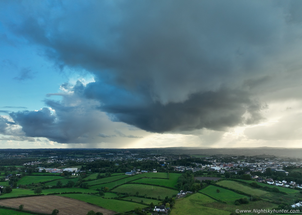
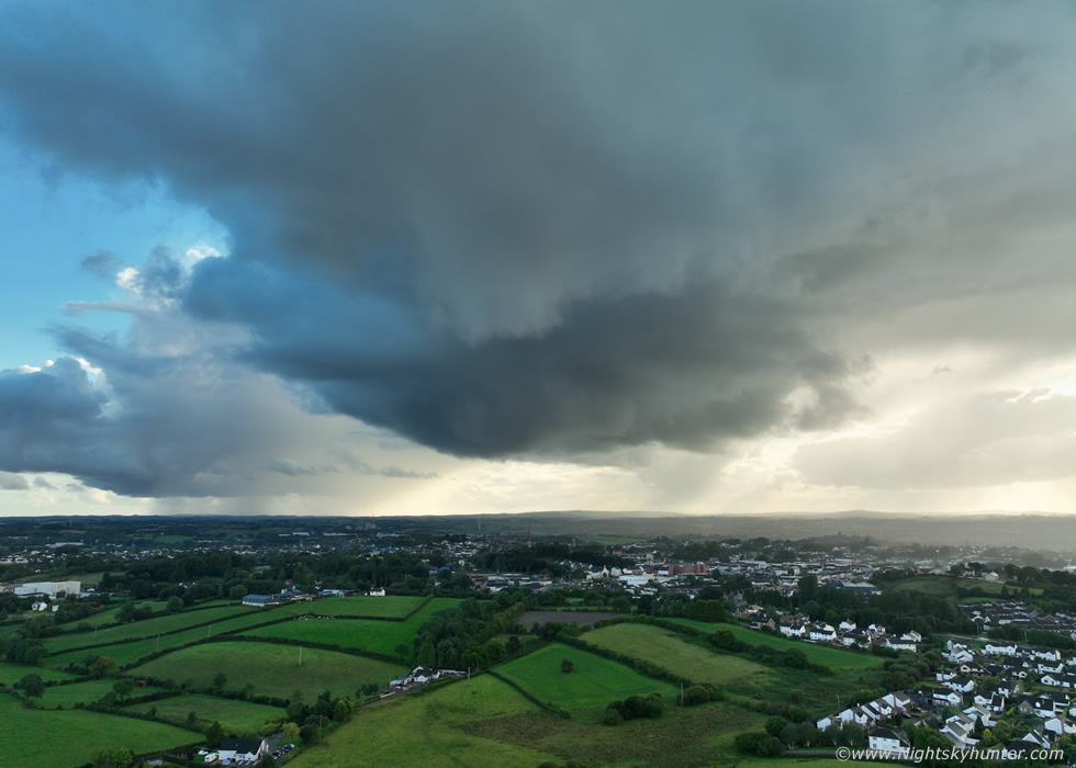
I ended up on the Omagh road and took a minor road into the countryside not far from Kildress and already my target cells was coming into view so I got the drone in the air to escape from the tree-cluttered foreground for a better view. This was that sheared cell, now between Omagh and Cookstown and stretching far out of frame to the right over the Sperrins. I could tell through the gaps that the tops were low but it did have a long base with heavy precip along much of its length. To tell you the truth this was more than I expected, I was actually seeing storm clouds, such a rare sight this Summer so I quickly became invested in the day.
I flew the drone for a while then watched the line approach, it weakened, then passed over me raining for a time. I decided to head back home to Cookstown for another radar check. Things went quiet for a while and the visual sky wasn't great so I did other things. After 17.00 Roisin and I went for a walk near Moneymore, while doing so we observed a cell over the Sperrins sheared for miles downwind with a base, this got my attention, it actually looked half decent, it was making its way towards our direction so I would get a better view soon. Roisin and I then drove back to Cookstown along the carriageway when the base of that cell came into view, a few minutes later it was almost over the road. The base was very cool looking, clearly an updraught base with complex textures, I wished I could have pulled over and got the drone up but I was driving and it was too late. This encounter changed things for me, this day was actually happening, something cool was getting produced by the shear. I went back home, consulted radar, observed several cells in my area and got ready.
 |
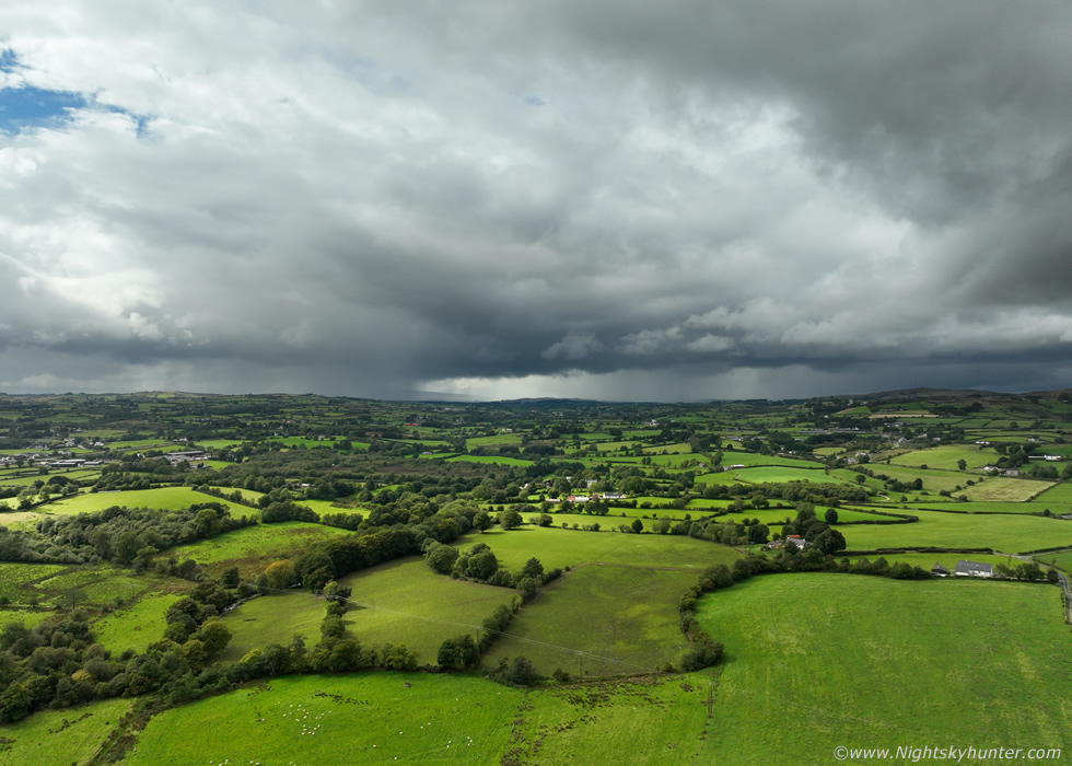
Heavy rain passed over from a red core on radar, once it cleared and the rain stopped I could see beautiful white convective tops appearing from the back of the cell, this was hands down the best looking sight I had seen all day. I went down the road a few hundred meters and got the drone in the air for a better look. This was facing NE from Cookstown at the flanking area (rear) of that retreating cell. The sun came out and lit up the convection, it had blue sky around the towers and a partial bow below and looked quite photogenic, I would take that. It's important to understand the invisible atmospheric dynamics at work here which might be difficult to perceive from this angle. The towers are leaning over and away from the drone and blown to the NE (sheared), this is an organized cell, and little did I know that I was watching the berth of a thunderstorm.
 |
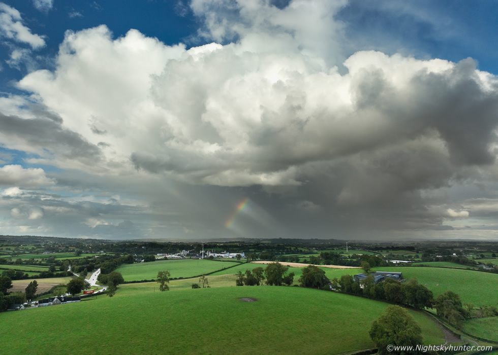
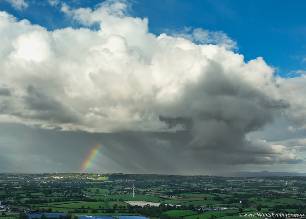
I panned the drone back around to the SW to get a visual on the other cells showing on radar. These were very interesting, two cells on view to the SW of Cookstown. The distant cell is near Dungannon and the closer cell was approaching Cookstown itself, take a look at the visual aspect of these showers, they all have the classic characteristics of highly sheared convection. First look at the Dungannon cell, well defined rain free updraught base, tilted updraught tower, precip and anvil sheared away from the base. The Cookstown cell is the exact same only closer, the updraught is hidden behind cloud however the updraught base is identical to the Dungannon base. Isolated, rain free, well defined, inflow dominated.
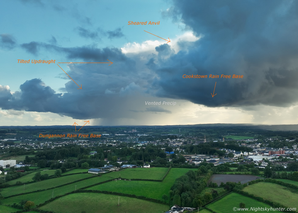 |
Cropped image from another wide angle capture with annotations explaining these visual cues. Both of these low topped cells are experiencing 40 knots of low level and deep layer shear. For anyone reading this who doesn't understand the updraught base is where a cell is ingesting warm humid air (inflow) so in a sense it's feeding from the atmosphere and surface moisture, this allows
Let's imagine this same scenario but this time in an atmosphere with strong speed shear (increasing wind speed vector with height). As the updraught grows it encounters these stronger winds aloft which cause the updraught tower to lean over (tilt) away from the base, as a result precipitation will get vented away from the inflow area so the inflow and outflow regions become separated, the cell is then organized and can live longer. In essence you are looking at 'mini supercells' and this was what was happening over Co. Tyrone with these two cells.
 |
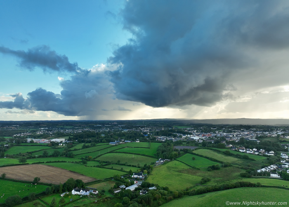
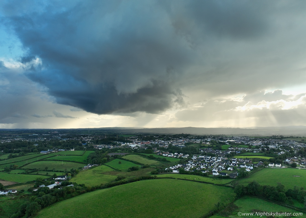
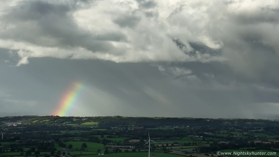
While waiting for the Cookstown base to get closer I took another look at the rapidly departing first cell which was now developing multiple red cores on radar and passing over Co. Antrim. Colleen Webb from Portglenone was watching this very cell approach her location, from her perspective she was viewing it face-one as a wall of precip, perhaps with gust front traits. That's the carriageway into Cookstown on the left and the famous Dromona cream factory below the bow.
 |
Rotating the Mavic 3 Classic back to the SW and the sheared cell was rapidly approaching my home area, I actually couldn't see it due to tall trees which was why I was savoring the view through the drone. I was impressed by what I was seeing, this was without question a compact well formed rain free updraught base on a strongly sheared cell. The precip was vented far down range to the right and beyond the frame allowing the base itself to be clearly visible far separated from any outflow. The base even looked rounded with inflow lowerings and even what looked like a subtle striation ring/fold around the lower portion of the leaning tower. These kind of bases are exactly where rotation, funnel clouds or even tornadoes can form, it was this type of structure which encouraged me to do the convective outlook earlier.
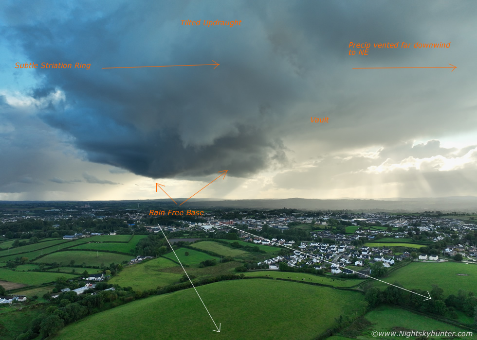 |
Annotated version, also note the 'vault', this is a region of the cell/storm which has little or no visible precipitation for the exact reasons I mentioned above. The strong shear aloft was blowing the precip away from the updraught base, this allows the base to feed on a steady supply of inflow unimpeded. The white arrows indicate the direction of motion, the base was moving directly towards me (NE). This is why when chasing sheared storms and supercells a chaser needs to stay ahead of the approaching base yet at the same time stay outside the precip. A good policy is to be located to the E or SE (right) of the base, which by default I was here.
 |
Base almost on me, these are all wide angle images, quite an impressive scene all the same.
 |
Another image of the Portglenone cell and cropped in closer to show the updraught region to the right, the shadow of the Cookstown base was getting cast upon the updraught of the more distant cell. I then got a message from Colleen Webb, she had just experienced several c-g lightning bolts followed by angry rumbles of thunder, this was a thunderstorm. I was pleasantly surprised, the tops must have got a fraction colder and this overlapped with peak heating and maximum shear must have tipped the scales, whatever the reason we were both delighted, what a result on such a marginal day with very low expectations. Nice anti-crepuscular rays too.
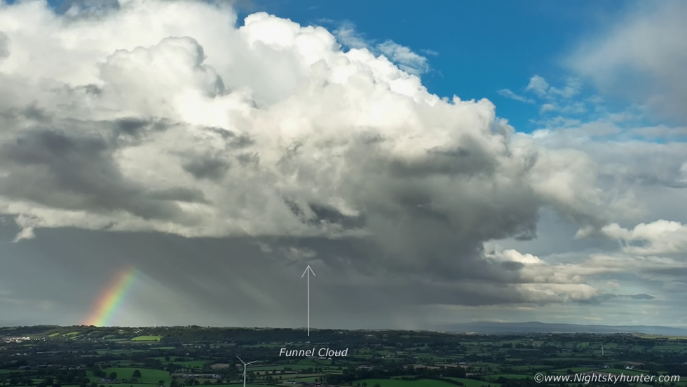 |
I began recording video of that storm and slowly panned the drone from right to left to show the updraught region when I spotted what looked like a funnel cloud. In fact, I was now certain of it, it remained persistent and was in the correct position, a horizontal rope funnel. Above is a still frame from the video.
 |
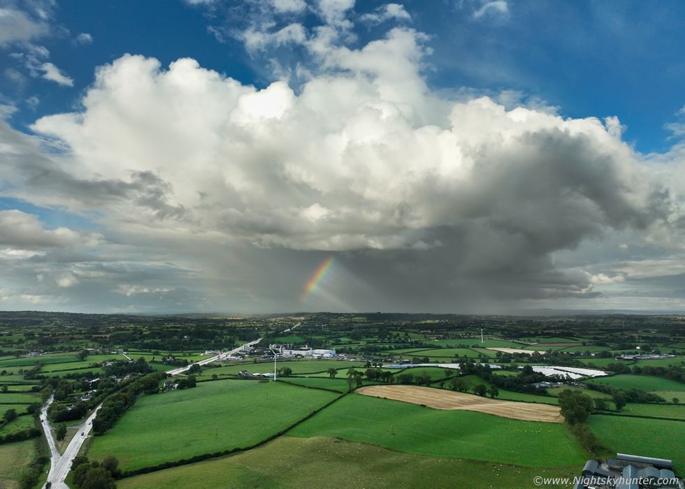
Video still cropped in closer, rope funnel and rainbow, I wish that funnel had been closer but I was still delighted to have captured it, yet again this isn't surprising given the low level shear, in fact, in parts of the USA these are sometimes called shear funnels.
 |
One last look to the SW, the shear was venting precip over me now and it was starting to drop on the drone too even though the base was clear and dry back there, but it was approaching fast and I would loose it from view due to the rain shortly, so one last image. With the exception of the recent night time lightning plume event this day actually produced the most photogenic clouds of the season and the best structure too. It made me wonder, what if we had our usual 800-1000j/kg of CAPE, what if we had our usual -40c tops, if we did have thesel usual parameters we would have had an outbreak of photogenic supercell thunderstorms!
Drone footage of the various cells from 15.00 to 19.00, I landed the drone with rain falling, the drone was wet but wasn't damaged, it done me proud. As soon as I got it packed away heavy rain fell from the forward flank downdraught and I lost sight of any other structures. An interesting day that I felt justified to cover, after all, we got a thunderstorm, funnel cloud, and sheared/supercell traits, I will take that in the meantime until the big CAPE days return once more. Thanks very much for reading.
Martin McKenna